


WeTrek Plus subscription
22,99 € / year
With the WeTrek app, the experience is complete. From preparation to sharing experiences, and on-the-ground navigation, you have all the tools you need to enjoy beautiful hikes throughout France.
- Description
- Subscription
- Features
- Mapping - Data
- Device Compatibility
- Assistance and Advice
Description
Discover the WeTrek mobile app, compatible with iOS and Android.
The subscription is only compatible with the WeTrek mobile app.
Test the mobile app
Download it for free from Google Play Store or the AppStore.
Upon the first installation of the WeTrek app, you’ll have access to the full version during a 7-day trial period. It will automatically stop after the 7th day.
Subscribe and activate your subscription
To access all the features described below, subscribe to the service.
Once subscribed, the subscription will be immediately available, and you can activate it by following the link below.
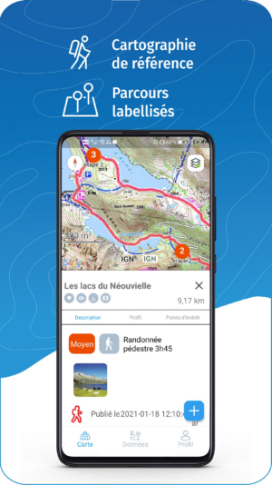
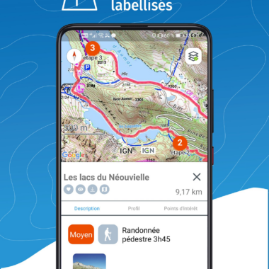
- Access to WeTrek routes, points of interest, and community
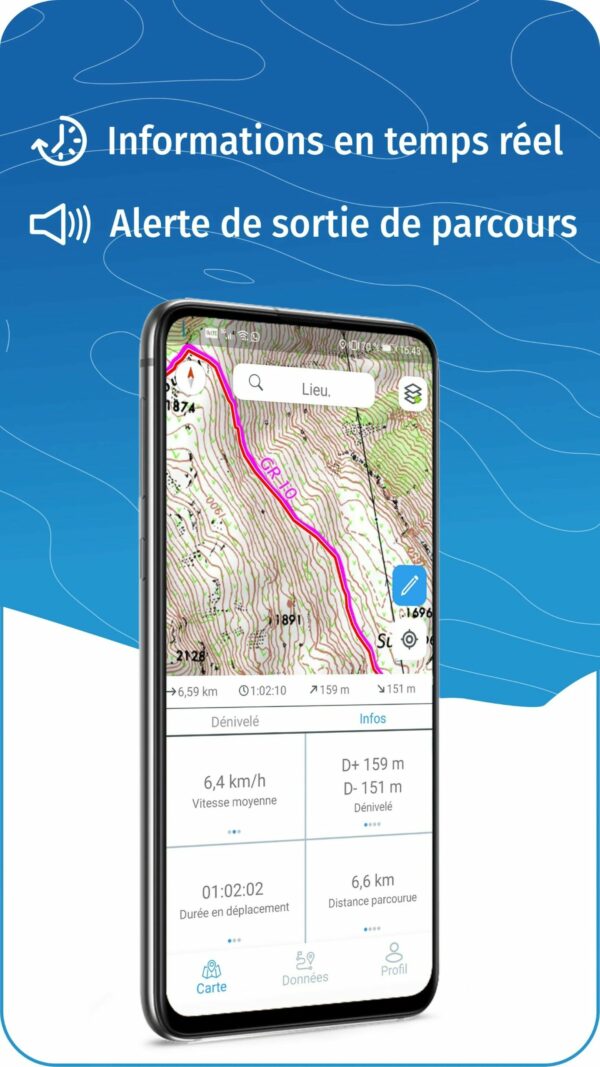
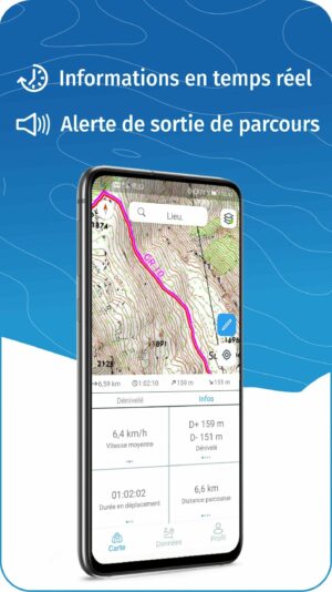
- Geolocation and GPS navigation on trails during your outings
- Import / Export GPX + Manage routes and points of interest by folder
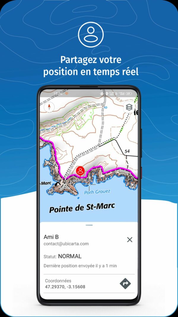
- Share your location with loved ones
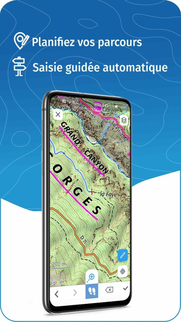
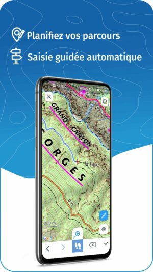
- Record and create routes with automatic guided input
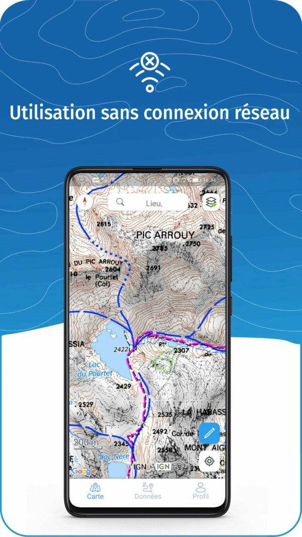
- Download maps for offline use without an internet connection
- Report issues and anomalies on the field
List of maps available for free in the WeTrek app (saved with subscription):
- IGN Map
- Aerial Photographs (IGN and Planet Observer)
- IGN Spain, SwissTopo
- OpenStreetMap world mapping (Outdoor), OpenCycleMap (for cycling activities), OpenSnowMap (for skiing, snowshoeing, etc.)
- European emergency number mobile network coverage (112)
Maps and data available with your WeTrek Plus subscription:
- Multi-scale IGN Maps
- IGN TOP25 Maps (topographic maps at a 1:25,000 scale)
- IGN Historical Maps (IGN maps from 1950 and State-major Maps from 1820-1866)
- ICAO Aeronautical Navigation Maps
- Network of roads, paths, and trails (aiding in data entry)
- IGN Slope Maps for snow activities (overlay layer)
- Cadastral Parcels (overlay layer)
- Drone restriction zones (overlay layer)
- DCFI Grid – Defense Against Forest Fires (overlay layer)
- French mobile network operators coverage (overlay layer)
Android Device:
- Requires Android 5.0 or later.
- Family/Private Use: Valid on up to 3 devices simultaneously (connected to the same account).
Apple Device:
- Requires iOS 12.0 or later.
- Family/Private Use: Valid on up to 3 devices simultaneously (connected to the same account).
Required storage space for maps (indicative):
Downloading maps and data for offline use requires storage space on your smartphone.
- Each route (without a downloaded map) takes up an average of 5 MB.
- Each downloaded map for a route takes up an average of 25 MB.
- Each downloaded map for a 10 km by 10 km area (100 km²) takes up an average of 250 MB.
The above figures are indicative and may vary depending on the route length and the type of maps downloaded.
Online Help and FAQ
Contact Us